Muir Snowfield with Chris
Chris and I went up to Paradise at Mt. Rainier on his most recent trip to Seattle. Chris had wanted to do a day hike up to Camp Muir and back (a hike I did over two days over a year ago) but we decided this would be too much for a day hike. So, the goal was to get up on the Muir Snowfield for a bit.
The drive down was pretty non-eventful. We drove a bit out of the way (around the south of Orting) to avoid The Puyallup Fair which proved to be a wise choice. To boot we drove by a 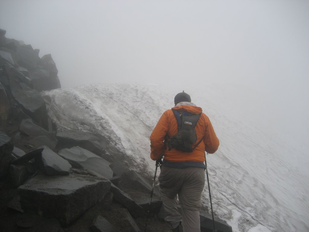 maize maze. Past Orting the traffic was very light as the forecast was for fog/rain at Paradise.
Paradise was mostly fogged in as we got to the visitor's center and it was also rather brisk. I had left my bladder at home so I wanted to get some water at the shop. We also only had one pair of gloves and hat so we each bought one of each to stay warm.
The hike starts at 5400 feet and takes the Skyline Trail up toward Panorama Point (there are weaving trails through this area – you could take the Alta Vista Trail slightly to the east (much to my chagrin this was the Spanish pronunciation. Chris has been pronouncing Vista (as in Windows Vista) “veesta†all week to irritate me and now he had a legitimate reason to pronounce it as such) but veers left and upward to Pebble Creek before reaching the snowfield. We saw a few hikers coming down who had not made it very far up the snowfield – in fact it was snowing at that altitude.
Pebble Creek is about 7200 feet which we reached in a little over an hour. We ran into a group of three – a couple and their friend – and it was her first time on the snowfield. In fact we later 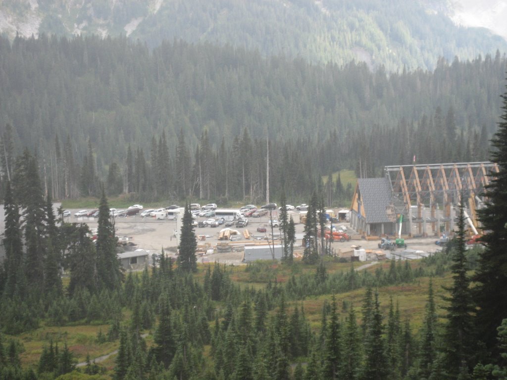 learned that she had surgery earlier in the year and resultant complications that resulted in several blood transfusions so this was quite remarkable.
We didn't get very far up the snowfield – 15 minutes or so – as the conditions were very foggy and icy. The snowfield was very low and there was a lot of exposed dirt out on the snowfield. Very odd.
On the way down we were able to get a good look at the construction on the new Visitor Center and Paradise Inn.
Toward the end of the hike the fog started to clear and by the time we were in Eatonville the mountain was clear on the horizon. We treated ourselves to Arby's in Puyallup on the way home.
As always, regardless of the weather, hiking around Paradise is wonderful. It was a good day on the mountain.
Deception Pass Loop
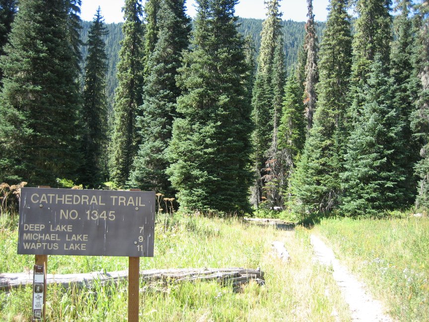 The trailhead is at the end of road 4330 north of Cle Elum and Roslyn off I-90. I took the path west from the trailhead and this takes you from the valley up to the mountains rather quickly. For the first couple of hours you are in forest but eventually you reach Squaw Lake which the first stop of the day.
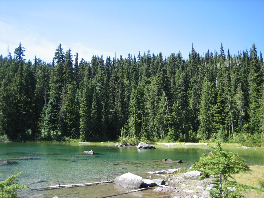 I met a group at Squaw Lake that had been backpacking for a week. A group of boys and fathers and they had been swimming and fishing along the way. Certainly a good adventure before coming back to school.
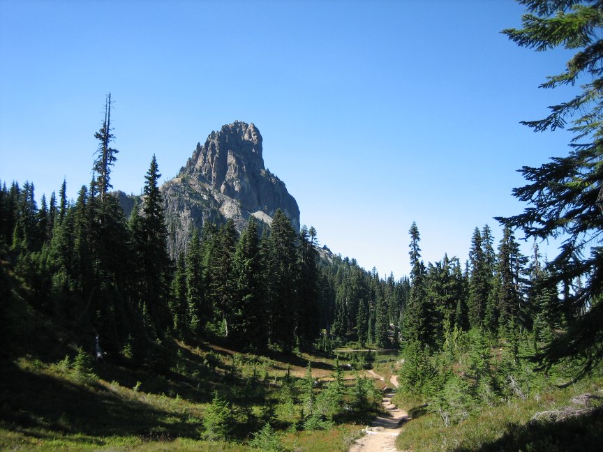 This is by far the best view of the rock. It is reminescent of Devil's Tower in Wyoming (made famous - or more so - by Close Encounters of the Third Kind) and is quite majestic. The spire is quite incredible.
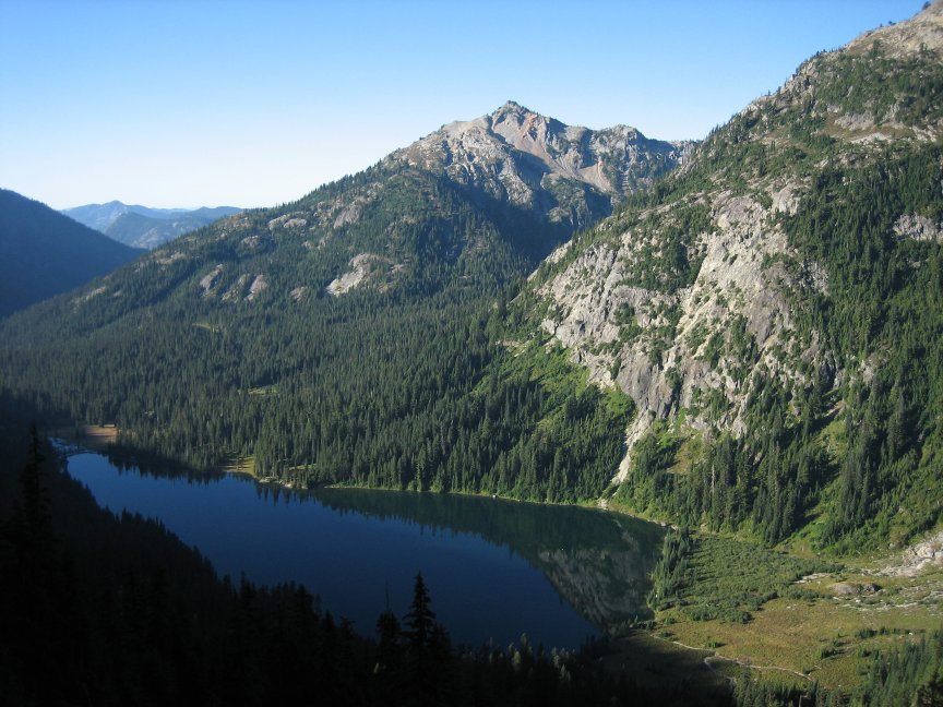 The top is 5600' and at this point I decided to turn south and head around Cathedral Rock to camp at Peggy's Pond. At this point you are on the PCT for just a 1/2 mile before you come to a "hiker's only" sign. This is the route to the pond. Along the way you are on the rocky slide under Cathedral Rock and the "moderately maintained" trail is a bit treacherous if you are not watching yourself. However, it is well worth it as you have views of Deep Lake and the valley beyond that are beyond spectacular.
 The night was uneventful other than the fact that I was sleeping under Mt. Daniel and Cathedral rock next to a still pond - AMAZING. I did wake in the middle of the night to do some business and the stars were just incredible - I think we forget how many stars there really are when there is no light to drown them out. I think I saw the milky way for the first time in years. The night was absolutely clear.
 So, here begins the adventure. The night before I totally lost when I turned onto the PCT (perhaps the bear/horse adventure rattled me at an inopportune time). So, I was trying to find the trail a bit lost although I knew about where it should be. I didn't find it - instead I turned north at what appeared to be a trail (a bit washed out...) through a slight valley that eventually descended into a dried out river bed. Again, I don't know exactly where the PCT was but I am sure it was 50 yards to the East on the ridge to that side. About 1/2 mile in I knew I was not where I should be climbing over boulders in said old river bed (the chili can from 1950 was a clue...) and I got to a point where I knew there was no way the trail was to the west of me - I could see the fact of Cathedral Rock - NO TRAIL. At an opportune time (finally) I moved east and up and the PCT was RIGHT FRIGGIN' THERE! Skill or luck - I don't care....
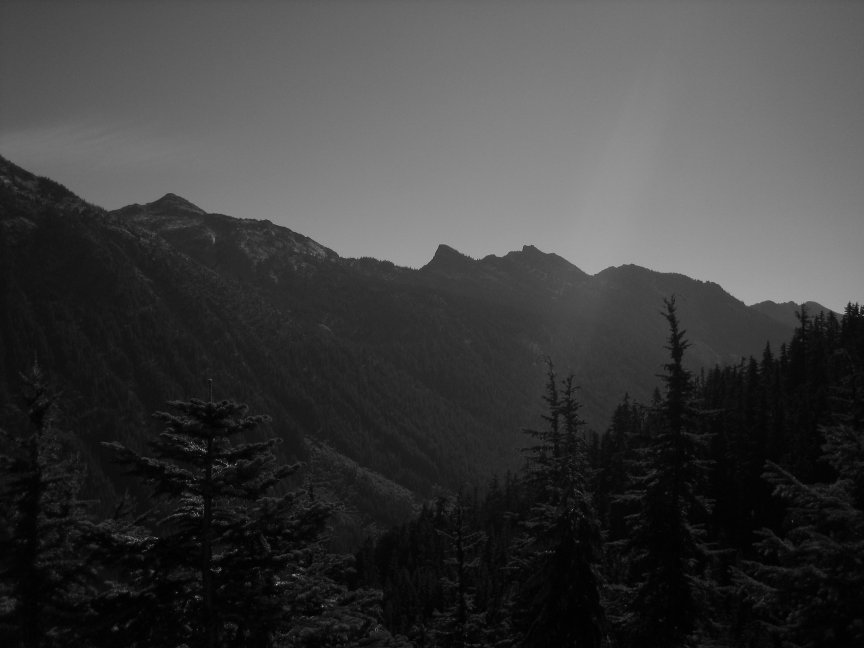 From Cathedral Rock to Deception Pass on the PCT is about 5.5 miles and I got there by noon. This involved two stream crossings that were pretty rocky and got my boots wet. This also involved a very nice and solitary hike with the moon following me along the western horizon. Vistas to the east across the valley remained and I periodically could see Lakes Hyas (little and "regular" I guess) below me through the trees. I saw only two groups on that stretch and this was only toward the end (yes, yes, yes - I could have passed someone earlier if only I'd been on the trail...). The first was three guys doing the Stevens to Snoqualmie Pass section of the PCT - something I aspire to in reverse. They did 5 miles the day before and were planning on doing this in 6 days. Well, this section is 67 miles or so so do the math - I sure hope they made it! The latter group consisted of two guys about 1/4 mile from Deception Pass.
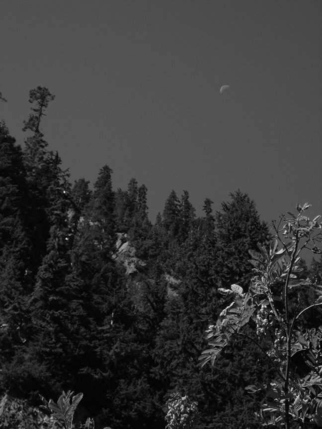 Now at this time I origially planned to head up to Marmot Lake but I had made good time to Deception Pass and frankly felt like heading home. I had been out of town that week and so really wanted to get some sack time in the old bed that weekend. I headed south.
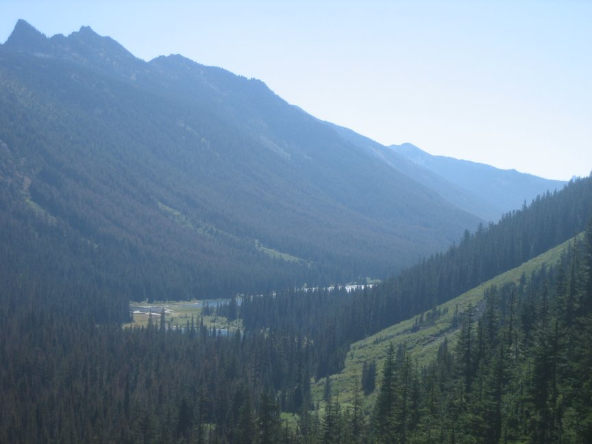 The rest of the hike was the usual last few miles. Several people along parts of the trail as dayhikers or overnighters who only want to travel in so far. I made it back without further incident.